
Long before we named places or drew borders, there was space — open land, sky, and the quiet surface of the world. When humans began to make sense of that space, they sketched it, named it, and arranged meaning upon it. The map you see is therefore not only geography; it is a mirror of thought.
MapMind™invites you to consider maps more broadly — as surfaces where human ideas, memories, and intentions take shape. In this light, a map can be a street plan or a document, a sheet of paper or a digital canvas: any ordered surface that carries the imprint of a mind.
MapMind™ is both a tool and a perspective. It aims to make it easier to see the ways we map our thinking — to explore, record, and share the mental landscapes that guide us. When MapMind™ is released, it will be free for everyone — a shared space for thought, curiosity, and creativity. We hope you'll download it and let your ideas rest on the map.
This gallery offers only a glimpse into MapMind™—a fraction of the integrated elements that shape its symbolic and functional architecture. Like the first breath drawn beyond a sealed chamber, this unveiling marks a quiet threshold: the outer world’s first touch with a system long held in intentional stillness. Its foundation remains unwavering, yet certain surface details may shift before the final release, refined to better honor clarity, resonance, and the spirit of its invitation.
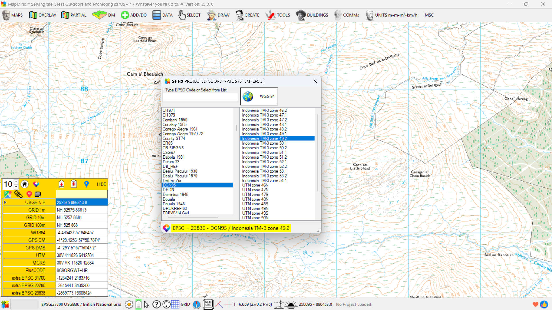
After installation, MapMind™ provides access to OpenStreetMap layers, tools to connect to any raster map server (such as WMS or WMTS), blank maps with selectable EPSG coordinate systems, and support for loading TFW and GeoTIFF raster files. It also includes a module to convert geotagged images into seamless raster underlays, allowing users to integrate scanned or external maps with ease.
MapMind™ also supports Digital Models of Terrain (DMT) by default, with SRTM as the standard format. Users can download terrain data directly using the in-app link, and a built-in tool is available to convert other DMT formats into MapMind™’s standardized structure for seamless integration.

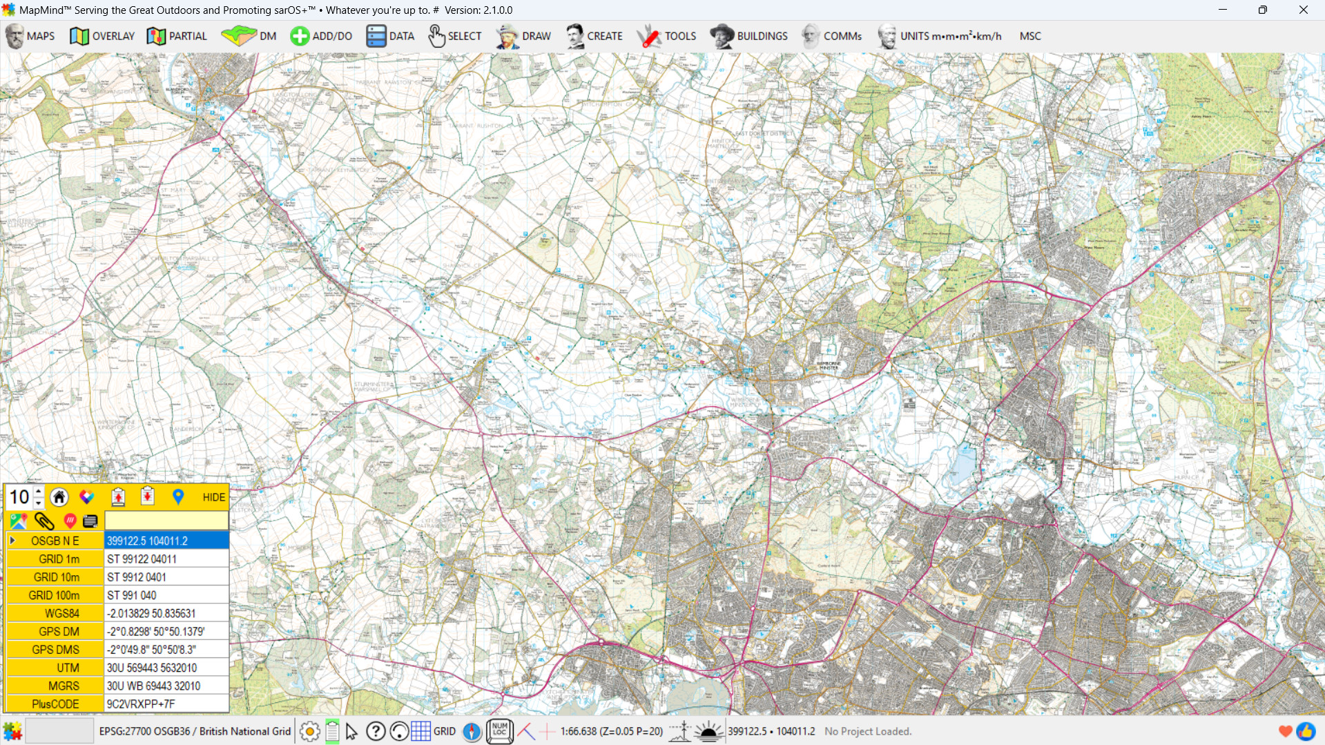
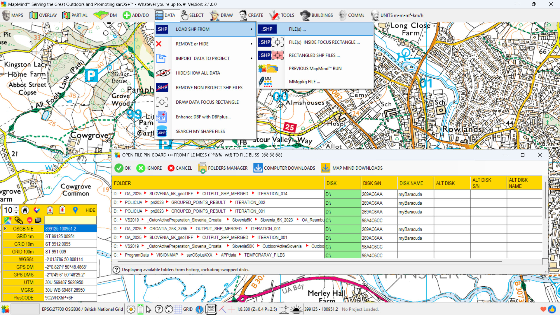
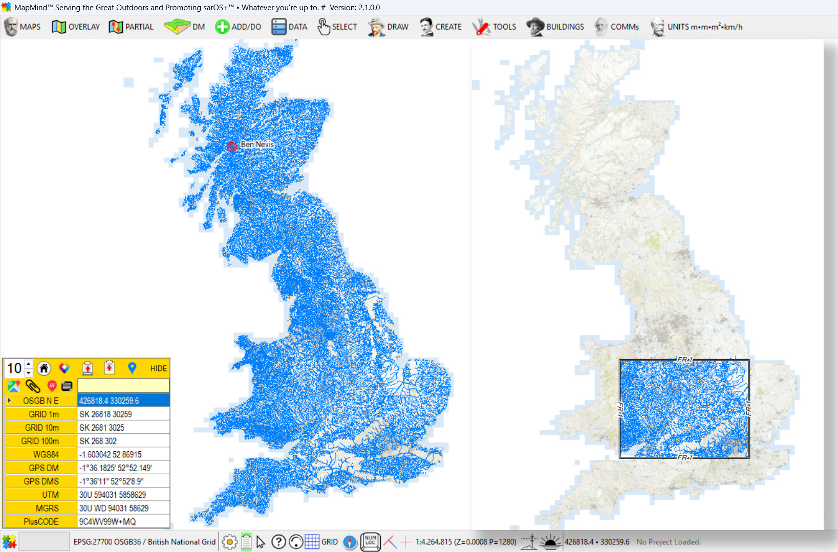
United Kingdom: The OS OpenData Hub is arguably the world’s most comprehensive portal for free access to raster and vector geospatial data—covering the entire UK, down to fine-grained details. Users must log in, then navigate to DATA > Downloads > Open Data or Sample Data to begin. Common formats include SHP, CSV, and GPKG—all fully supported by MapMind™. Commercial datasets from Ordnance Survey, like those shown in examples above, require separate licensing.
European Union: The INSPIRE Geoportal provides harmonized spatial datasets from EU member states. These include land use, hydrography, transport networks, and administrative boundaries, available in various open formats.
Global & Multi-Continent:
Africa: The Africa GeoPortal provides curated datasets for African countries, including administrative boundaries, roads, and land cover.
Asia: Open Data Asia aggregates datasets from various Asian governments and institutions, covering topics from infrastructure to environmental monitoring.
Americas:
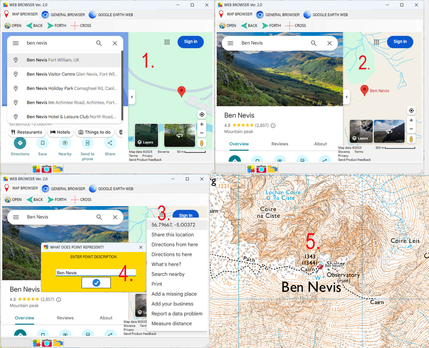
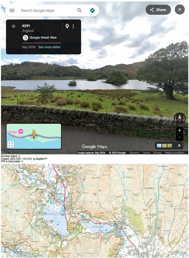
GPX Tracks: GPX files are widely available for download from hiking, cycling, and travel platforms. Sites like Wikiloc offer global coverage, and MapMind™ supports direct import for route visualization and analysis.
![]() ChatGPT: With well-crafted prompts, ChatGPT can reveal a plethora of mapping-ready sources—ranging from government portals and academic repositories to niche datasets for terrain, infrastructure, and biodiversity. It serves as a meta-continent of discovery, helping users uncover hidden layers of geospatial access across all regions.
ChatGPT: With well-crafted prompts, ChatGPT can reveal a plethora of mapping-ready sources—ranging from government portals and academic repositories to niche datasets for terrain, infrastructure, and biodiversity. It serves as a meta-continent of discovery, helping users uncover hidden layers of geospatial access across all regions.